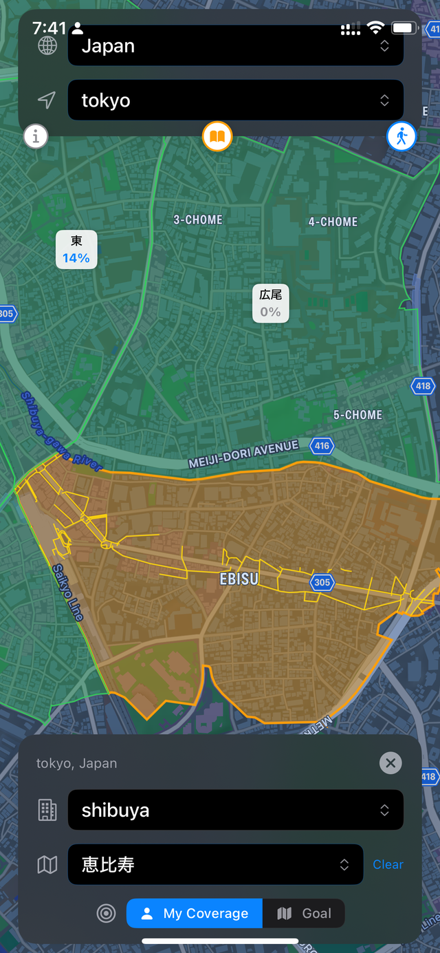
Also, every region has different ways of representing a “neighbourhood”, so I get to learn how to extract viable data from each city. Lots of map stuff, I’m genuinely enjoying it!
- It felt like what I wanted to achieve is pretty simple (GPS coordinates -> display all on the same map), so didn't want to subscribe for a monthly fee. I couldn't actually find an app that would dump all my HealthKit data directly onto the map, which was surprising.
- Last year when I wrote my app, I wanted to see how fast I can learn simple mobile development loop
- Now, I couldn't really find anything that divides the coverage areas into real-world neighbourhoods. So, think of West Village of NYC, or Yorkville in Toronto, or Yoyogi in Shibuya and etc. Back when I used to live in Vancouver, I would look at my own app, and kinda say in my head "aight, I've walked through every street in West End, Vancouver". Figured it would be cool to have a proper way of tracking it. So working on it currently.
- It's kinda fun to work on an app for my own needs
I'll take a look at the squadrats though! Looks pretty cool.
- https://uceed957a657be57d7d53af97504.previews.dropboxusercon...
It felt good when I was able to figure out how to generate all the neighbourhood data for any given city. A bunch of fun OSM data manipulation though.
If you meant the app that I wrote last year, it's here - https://apps.apple.com/us/app/mapcut/id6478268682. The idea is much simpler though, as I mentioned.